
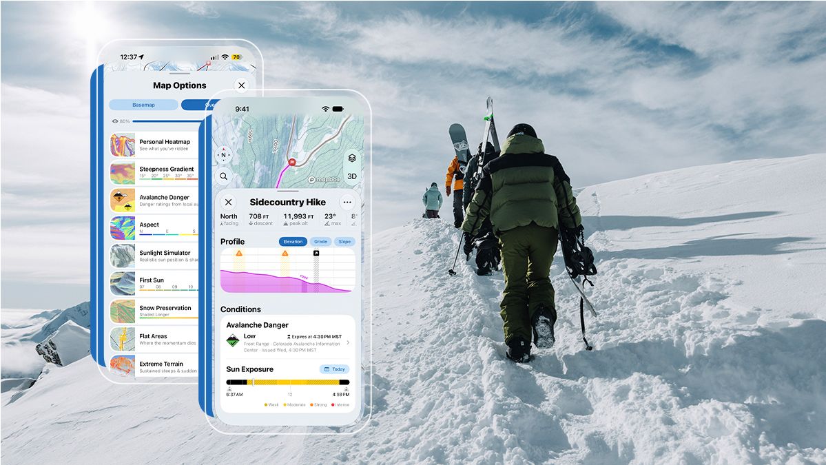
November 10, 2026 — Slopes: Ski & Snowboard today announces a major winter update designed to help skiers and snowboarders plan their days, understand mountain conditions, and explore new terrain. The update introduces advanced resort weather forecasts on the free plan, a new Guide tab with a personal mapping library for routes and places, and redesigned mountain maps with sharper terrain in both 2D and 3D.
Building on these improvements, Slopes is also introducing Slopes Explore, a new offering for skiers and snowboarders who want to take their mountain planning further. Explore adds advanced terrain insights, personal heatmaps, mobile route planning, and custom offline maps, giving users more ways to prepare for their next adventure, both within and beyond resort boundaries.
Slopes Explore: Beyond Resort Boundaries
Designed with backcountry skiers and snowboarders in mind, Slopes Explore gives skiers and snowboarders more ways to understand terrain before they head out.
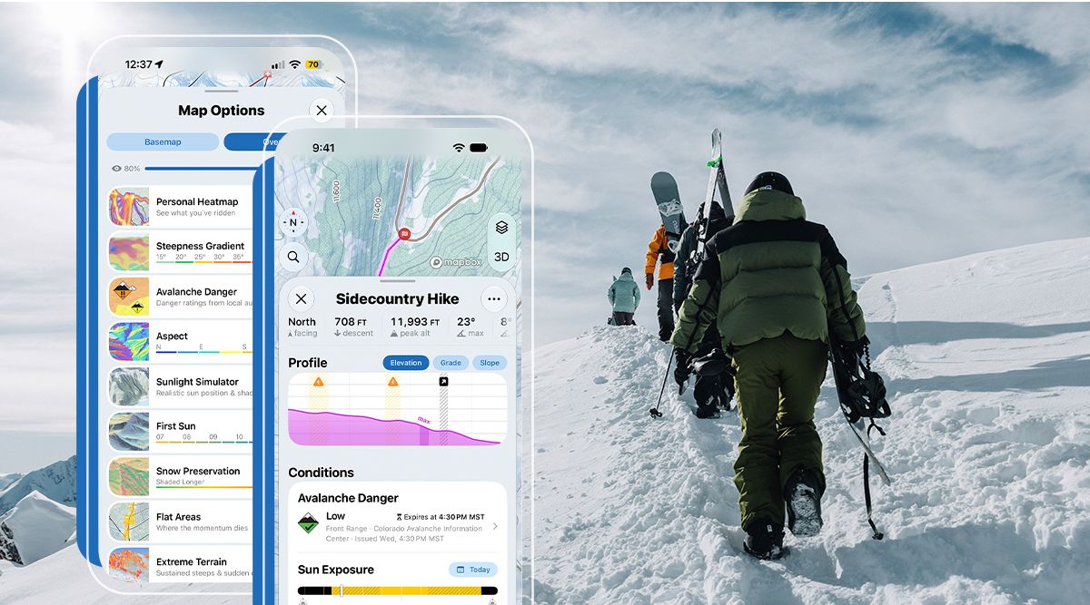
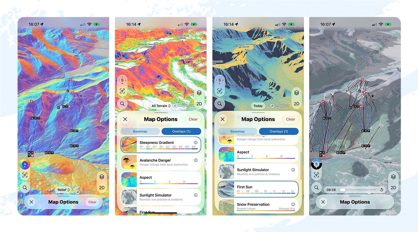
Interactive overlays highlight terrain features though tools like steepness and aspect coloring, but then go further with new types of visualizations. First Sun shows when sunlight first reaches a slope, while Sunlight Simulator shows sun and shade at a chosen date and time. The Wind Loading Simulator models where snow could collect or be scoured away under different wind directions.
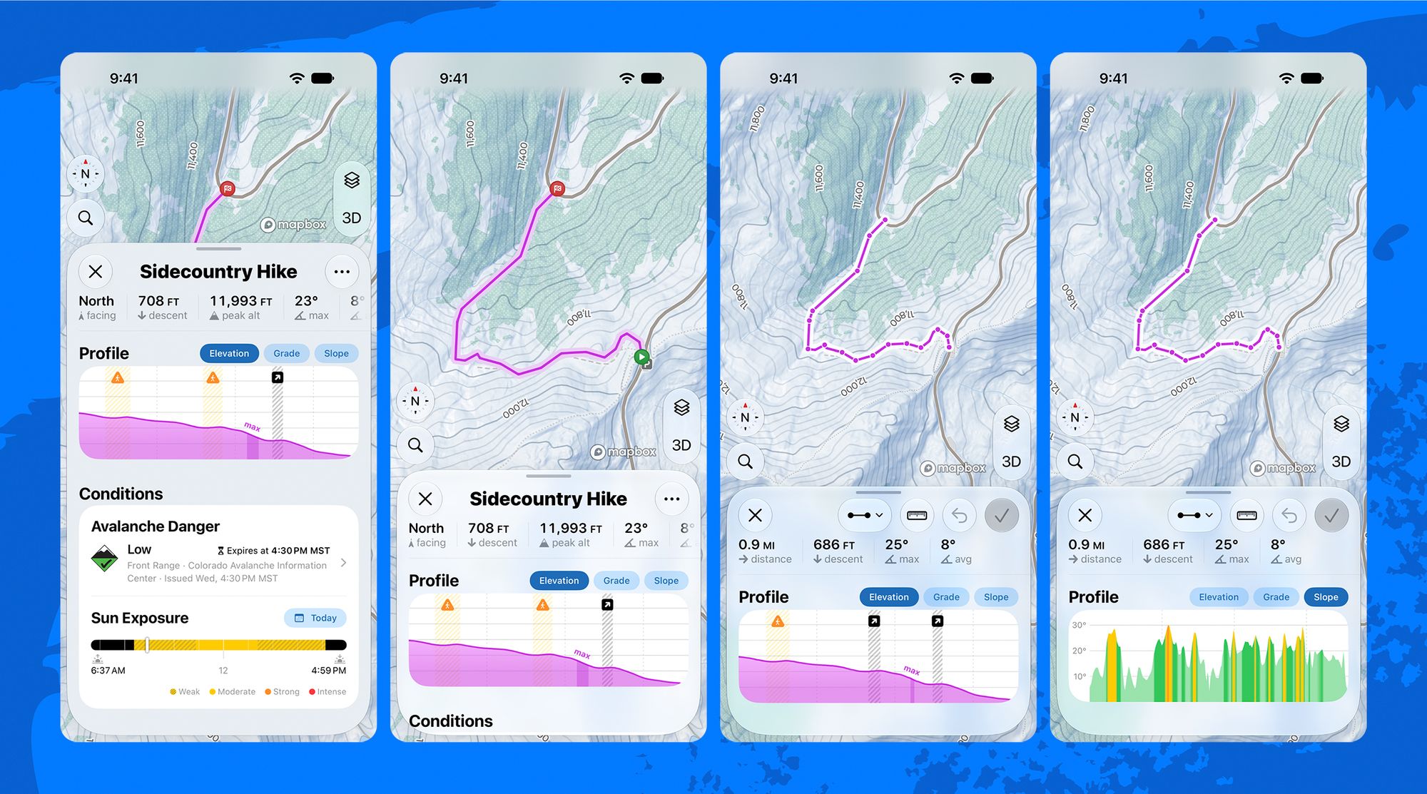
A mobile route editor and custom offline maps provide additional tools for planning trips into the backcountry. Users can draw and edit routes on their phones and compare the grade of a climb with the steepness of the terrain it crosses.
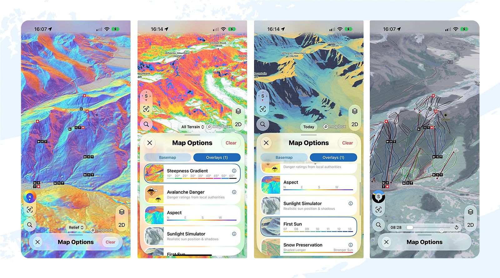
Explore also introduces Personal Heatmaps, allowing users to visualize their past Slopes recordings, see where they've skied before, and identify new areas to explore.
Alongside these advanced tools, the update also adds free avalanche forecasts from 73 forecast centers in 20 countries. The latest available danger ratings from local forecasting authorities appear as a map overlay and on planned routes.
While particularly useful for backcountry adventures, the new planning features also offer resort skiers more ways to explore familiar mountains.
A More Personal and Detailed Mapping Experience
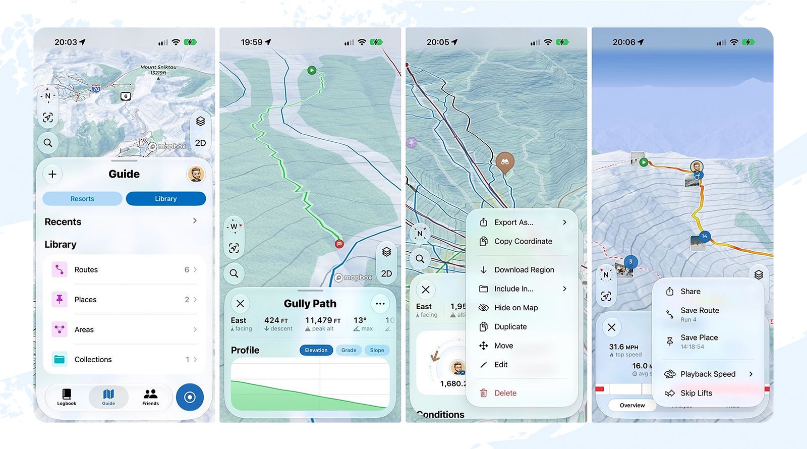
Beyond Explore, Slopes is introducing a new Guide tab, bringing Resort information together with a personal library for saving routes, places, and collections. Users can import existing routes from other apps, turn previous Slopes recordings into saved routes, and organize locations with custom pins and notes. These core library features are available for free.
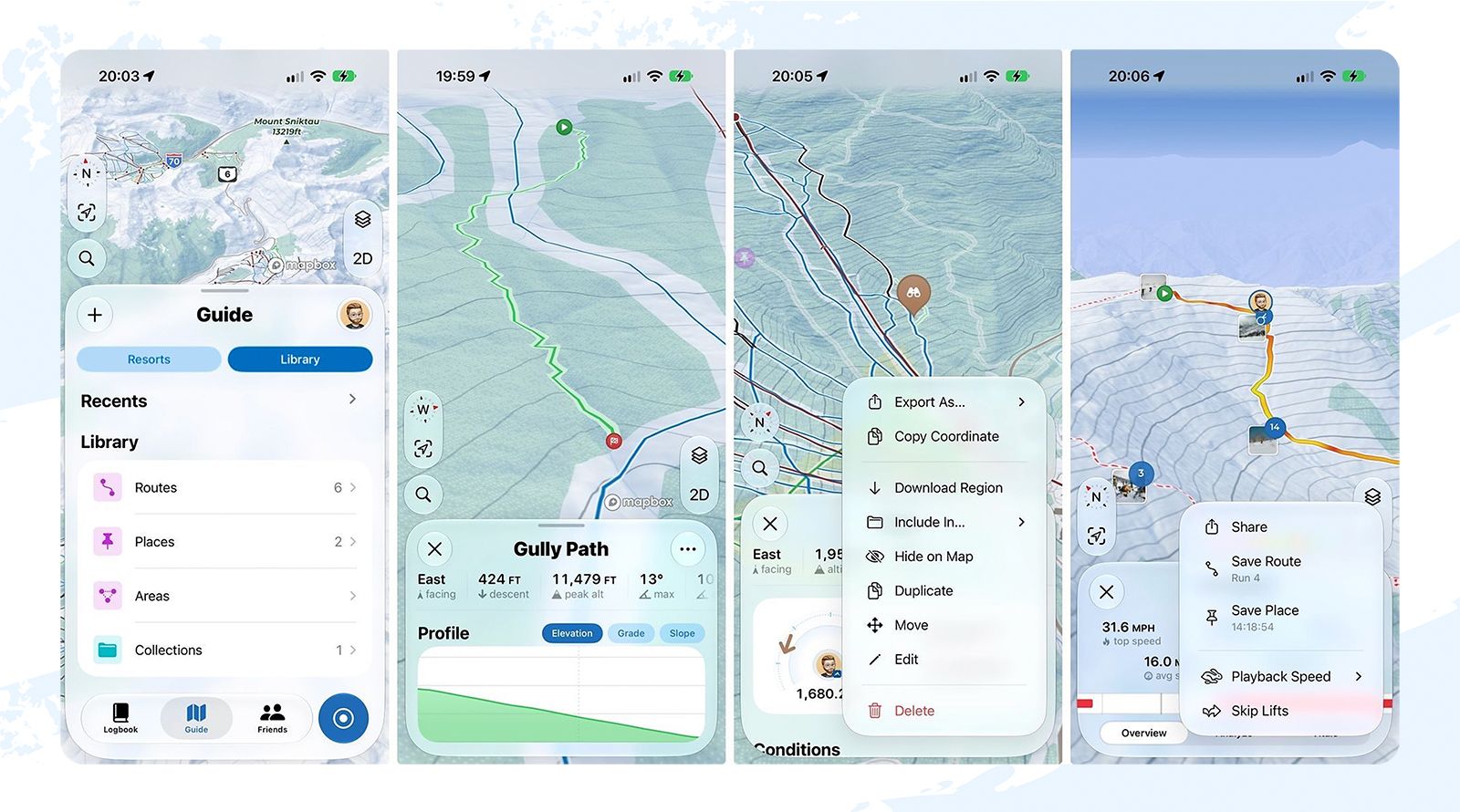
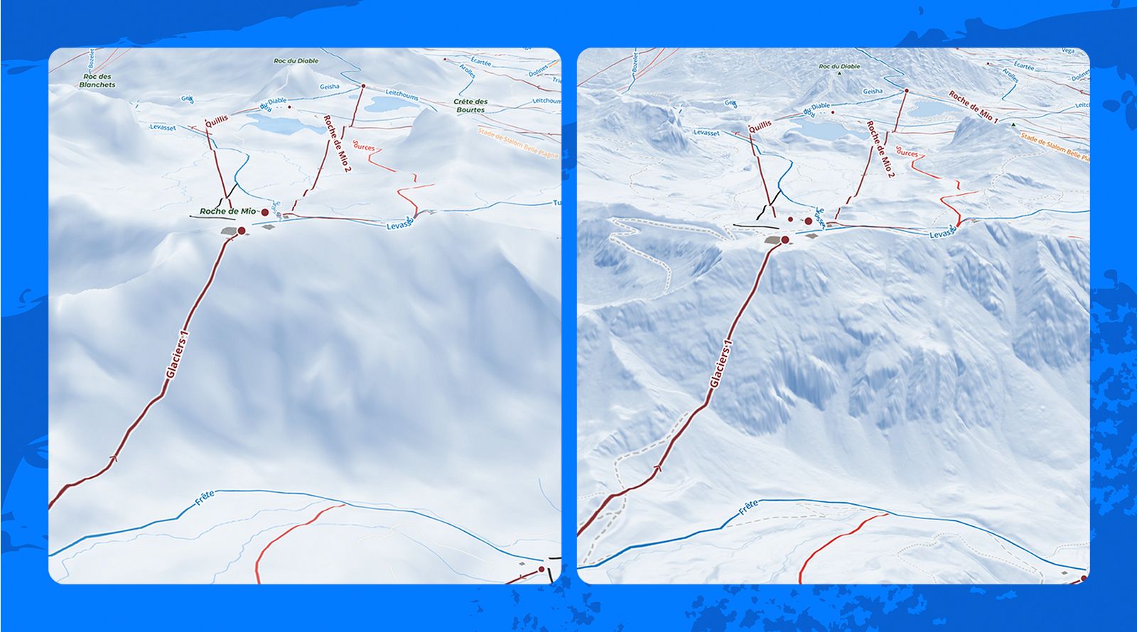
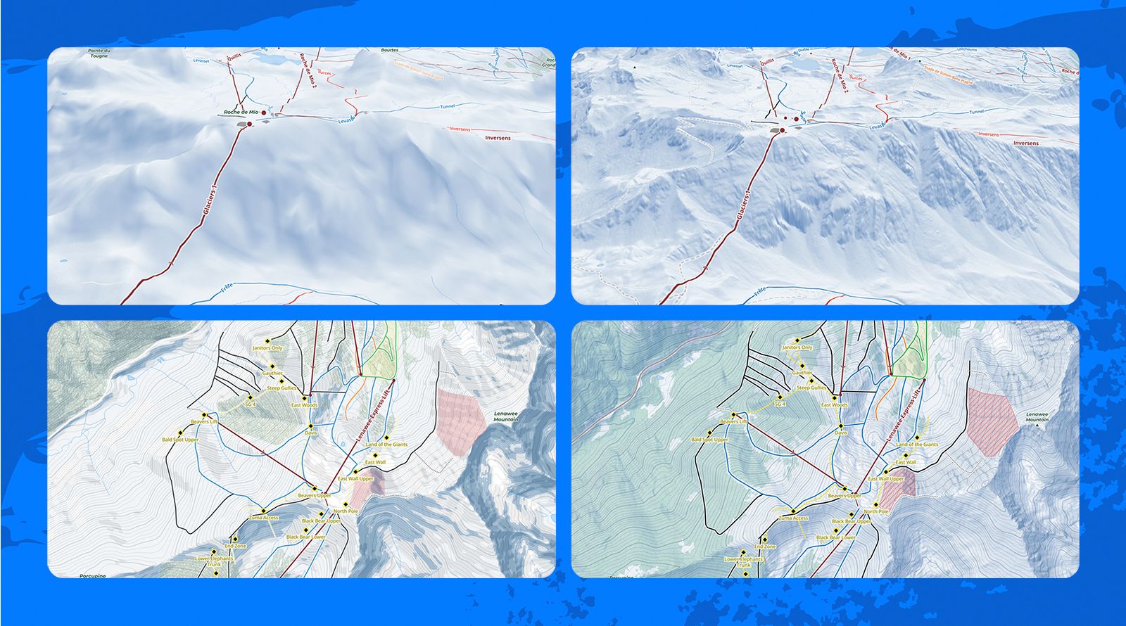
Slopes' redesigned mountain maps add clearer terrain details, improved tree coverage, and more detailed representations of trails, roads, and mountain landmarks. A high-resolution digital elevation model (DEM) powers both the 3D terrain and the hillshading shown by default in 2D. Slopes uses 10-meter elevation data at most ski resorts worldwide, with finer coverage down to 5 meters and, in some areas, 1 meter in parts of Europe and the U.S. For skiers and riders who miss FATMAP’s detailed terrain views, it’s a difference they can see when they zoom in.
Smarter Weather Insights for Better Planning
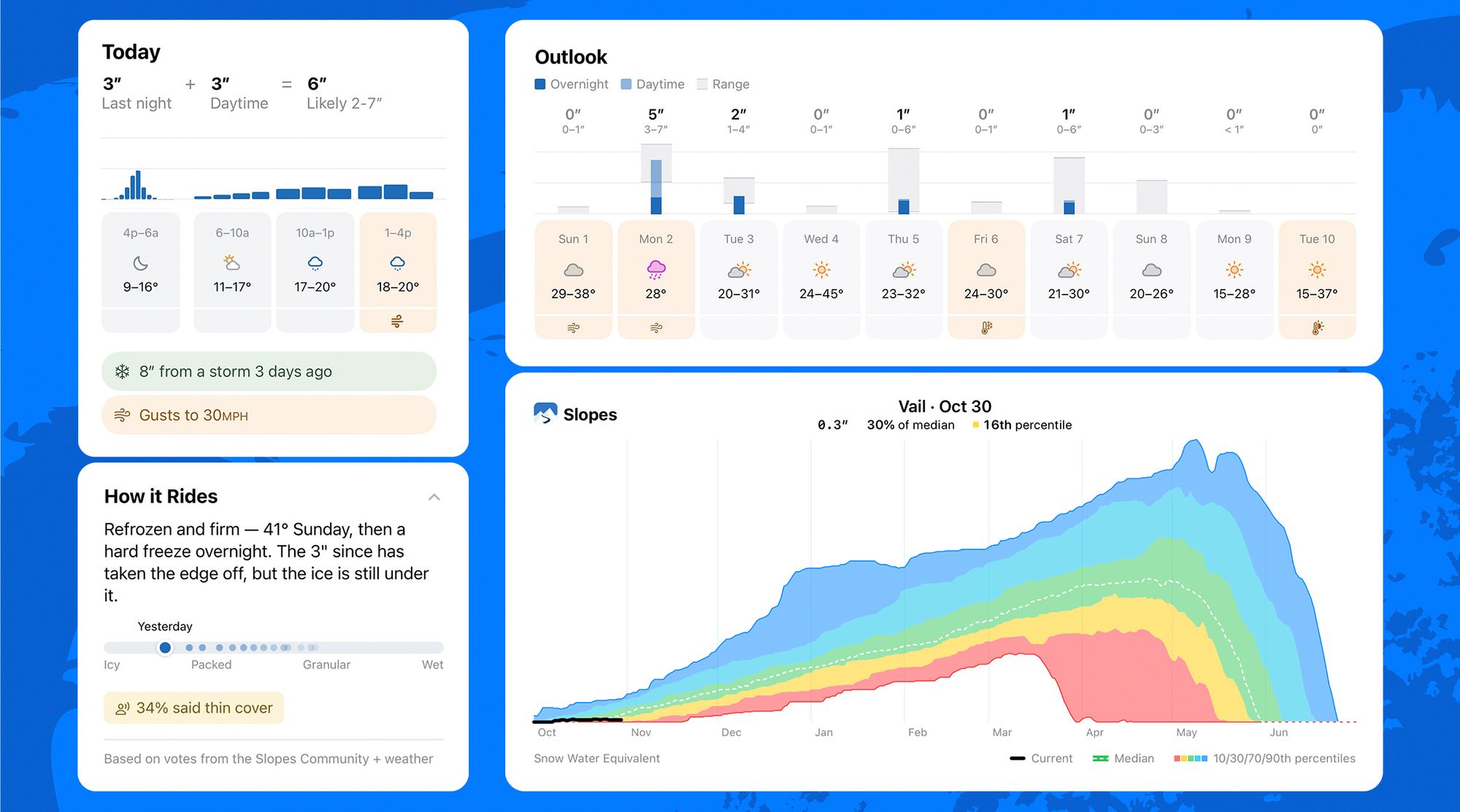
The seasonal update also brings improved weather forecasts and condition information to all Slopes users. Unlike traditional forecasts organized around calendar days, Slopes focuses on the ski day, grouping snowfall from the night before with the following day's forecast. The free forecast distinguishes between overnight snowfall (4 p.m. to 6 a.m.) and snow expected while you ride. That makes it easier to see what could be on the ground at first chair and what’s still to come. Slopes also flags conditions that could change the day, such as overnight freezes, daytime thaws, strong gusts, and recent storms.
New forecast details distinguish between snowfall expected overnight and during the ski day, while condition highlights help users identify factors such as changing temperatures, freeze-thaw cycles, and potentially disruptive winds. An extended 10-day outlook provides a broader view of upcoming weather, making it easier to plan mountain days in advance.
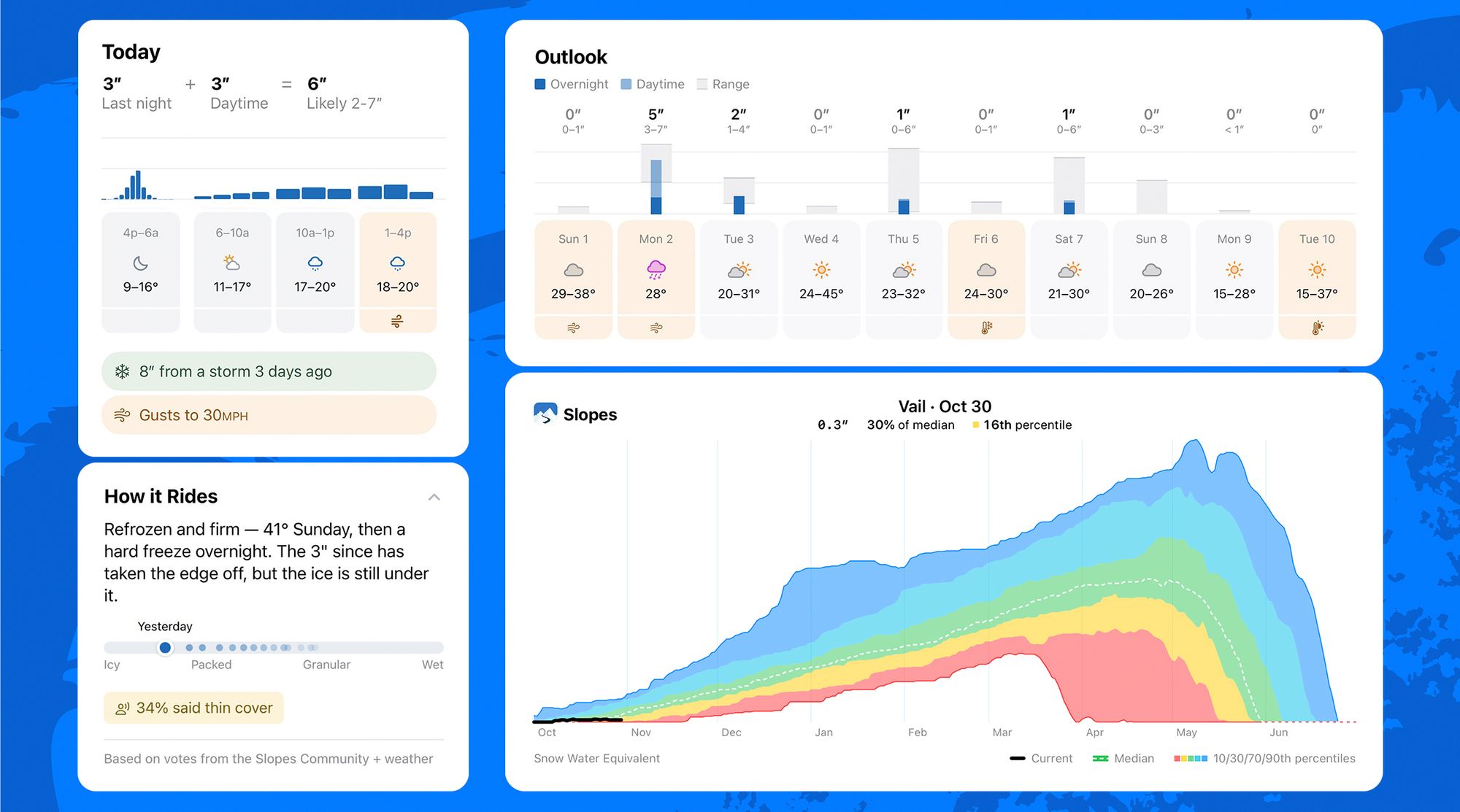
The redesigned How It Rides combines community reports with weather data to show how surface conditions are changing. Where SNOTEL data is available, users can also see how the current snowpack compares with past winters.
Availability
The free Weather & Conditions update begins rolling out on November 10, 2026, on iOS and Android. The Guide personal library, redesigned maps, and Slopes Explore begin rolling out the same day on iOS, with Android updates planned for later in the season.
The Guide library and improved weather forecasts are available for free. The redesigned maps are included with Slopes Plus, previously Slopes Premium. Slopes Explore is available for $79.99 per year, with eligible existing Slopes Plus subscribers able to upgrade for $59.99 for their first year. A family plan is also available.
About Slopes
Loved by skiers and snowboarders worldwide, Slopes is the leading winter sports app, with over 4 million active users across 250 countries. Slopes App does it all — from tracking your performance on the mountain, to delivering detailed snow condition reports to helping you locate friends on interactive 3D maps. Enjoy detailed stats and get ready to track, log, and showcase all your winter adventures. For more information, visit getslopes.com.
Press Contact
Amanda La
amanda.la@getslopes.com
Slopes: Ski & Snowboard
Download on the App Store
Get it on Google Play
Media Kit & Summary
Free Weather & Conditions
- Today and tomorrow forecasts. Snowfall is split between overnight and while you ride, with flags for gusts, freezes, thaws, and recent storms.
- 10-day outlook. See snowfall ranges, with overnight snow counted toward the next ski day. The resort list shows the next five days and the previous two for favorite resorts.
- How It Rides. Community reports and weather data show how conditions such as groomed, icy, wet, or granular snow change over time.
- Snowfall and snowpack. Resorts show 30 days of estimated snowfall. Where SNOTEL data is available, see current snow water equivalent, the historical median, and the range across past winters.
Free on iOS and Android starting November 10.
Free Guide library and Slopes Plus maps
- Guide. Find resort information alongside a private library of routes, places, and areas. Import from other mapping apps, save runs or lifts from past activities, and export to GPX, GeoJSON, or KML.
- Library organization. Add notes, choose icons and colors, and group items into collections you can show or hide on the map. Core library features are free with no item limit. Saved-route elevation profiles require Plus. Private collection sharing is planned after Guide comes to Android.
- Redesigned Plus maps. The topo maps show trails, roads, clearer buildings and parking lots, peak labels, and localized elevations. HD trees add detail inside and outside resort boundaries. The new DEM powers sharper 3D terrain and high-resolution 2D hillshading.
- Plus offline resort maps. Resort downloads now include elevation data for supported overlays, 3D terrain, and elevation graphs.
Guide is free on iPhone starting November 10. The redesigned maps arrive the same day with Slopes Plus on iOS. Guide is in development for Android, and the redesigned maps will follow later in the season.
Slopes Explore and free avalanche forecasts
- Explore overlays. Aspect, Steepness Gradient, Flat Areas, Extreme Terrain, Terrain Curvature, First Sun, Sunlight Simulator, Snow Preservation, Wind Loading Simulator, and Personal Heatmap. The heatmap shows individual tracks when you zoom in and lets you hide lift rides. Wind Loading models a consistent wind speed and snowfall under different wind directions.
- Free avalanche forecast overlay. The latest available ratings from local forecasting authorities appear on the map and on planned routes.
- Mobile route planner. Tap or draw freehand to create routes, move points, undo or redo changes, measure between points, and make an out-and-back or close a loop. Charts show elevation, route grade, and the steepness of the terrain the route crosses.
- Custom offline regions. Draw a download area, preview storage needs, and choose whether to include satellite imagery. Most overlays work with downloaded elevation data. When you edit a region, Slopes shows the area you’re adding and removing.
Explore launches on iOS November 10 at $79.99/year. Eligible Plus subscribers can upgrade for $59.99 for their first year at launch. A family plan is also available. Android is planned for later in the season.
